Tuesday, September 26, 2006

The Silver Moose comes home

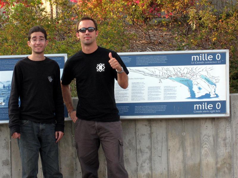
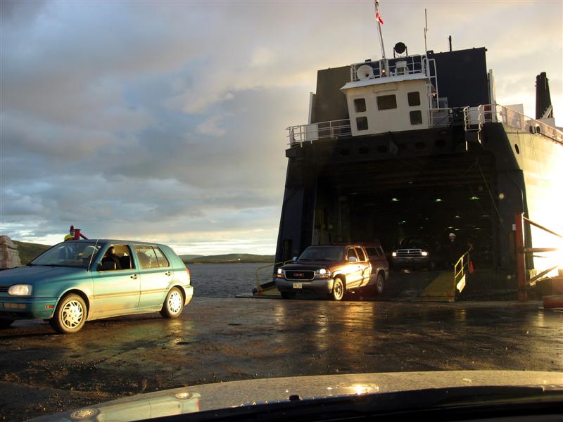
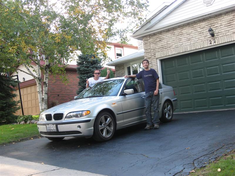
Back home: the only shot for Day 22 and hence the photo of the day
Day 22: Quebec ~ Thornhill (783km)
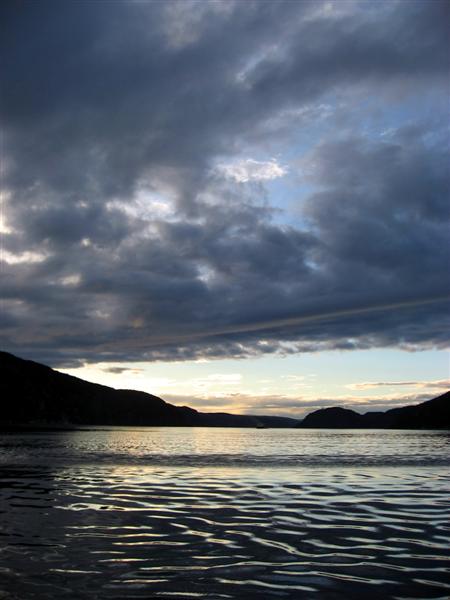
Another driving day, the final day, and we're home. Without a doubt the most uneventful day of the trip, consisting of almost 800km of highway driving, most of which down the Rte.20/401 forest-lined, divided highways. They give northern Ontario highways a good run for monotony. The only shakeup in the day was the frustration of trying to get through Montreal, which we did, but not without a 25-minute unscheduled detour through downtown. You'd think they could spend a little money on a proper highway bypass instead of a confusing knot that brings all the major expressways into the city before they somehow come out on the other side.
Anyway, we arrived back to the wonders of surburban Toronto shortly after 5PM, 22 days after we started this whole thing. The finish-line photo I took above is the only photo I took today, so it was a shoe-in for photo of the day.
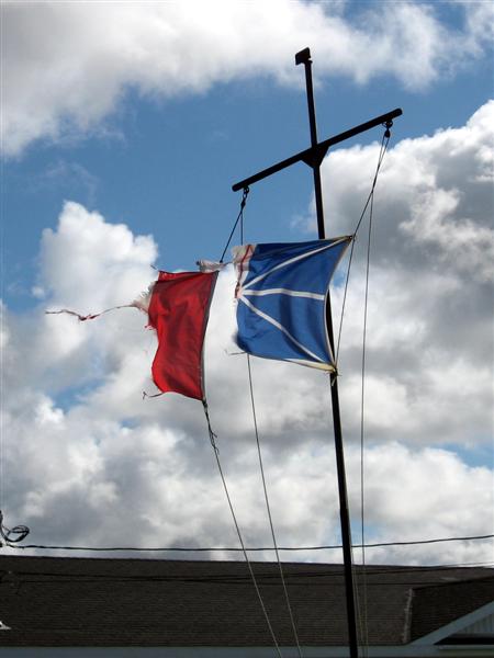
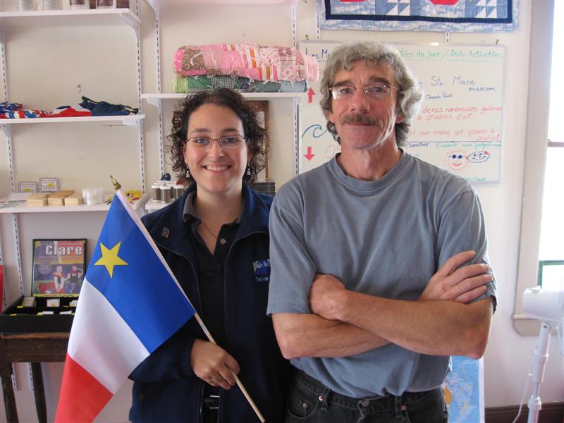
Some reflection on the past three weeks: Canada is indeed a wonderfully huge and diverse country. This trip and the drive out to Victoria three years ago have showed me that this nation is made up of the most incredible variety of people and peoples, all shaped by their culture, history, and the landscape that surrounds them. While there are certainly strong cultural and heritage affiliations in various places, be it the Natives, the Quebecois, the Acadians, the Innu, the Newfoundlanders, or the Labradorians (who insist on their differences from Newfoundlanders), the ties uniting us all are certainly there and can be seen, at least in one form, in the maple leaf that flies from so many flagpoles across the country.
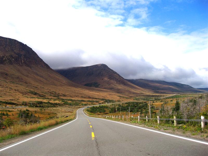
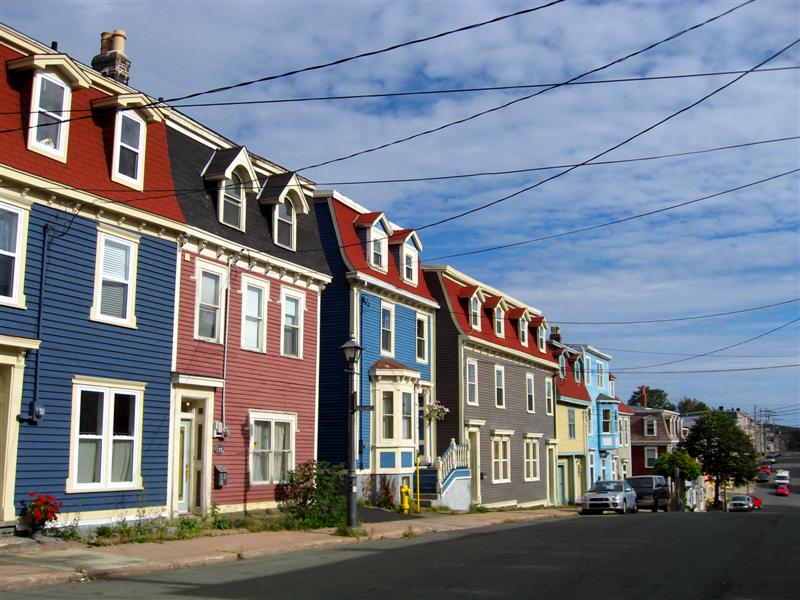
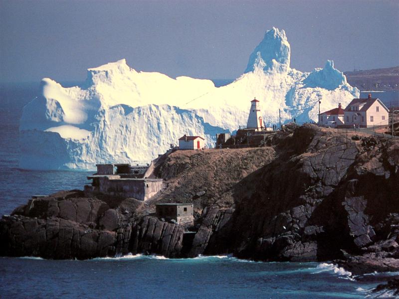
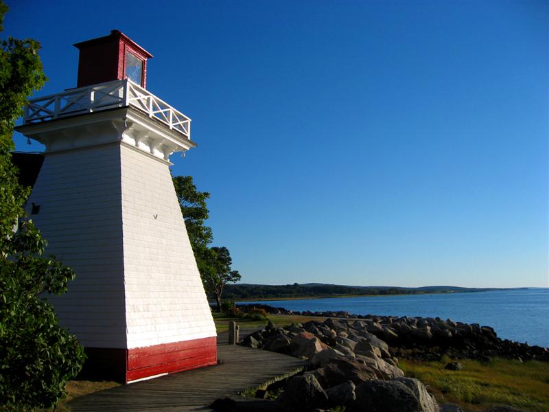
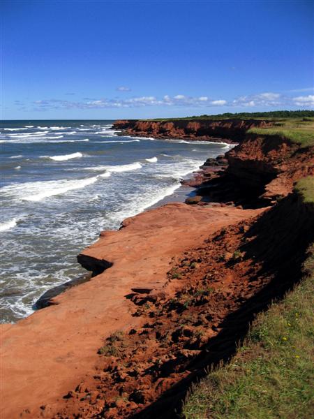
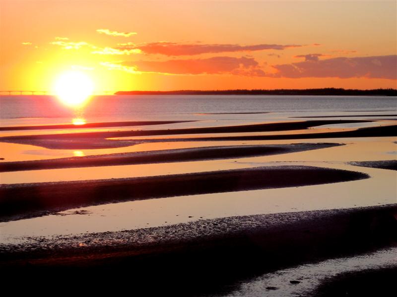
The Maritime and Atlantic provinces have a sometimes beautiful but sometimes harsh environment that has shaped a society overflowing with history into the friendly communities, large and small, that you find there today. They may not have the sophisticated, multicultural depth of Toronto or the modern, dynamic energy of Vancouver or Montreal, but they are equally rich in tradition thanks to a social and cultural palette that hasn't changed much in hundreds of years. And their comfort with this fact shows in their warmth to those that visit them.
Having travelled all over the world and with plans to do so again in the future, I can say that I have truly been enriched by seeing both shores of my own country and all that lies between, and I'll take those experiences and impressions with me the next time I go overseas, so that I can share them with the rest of the world.
Just for the record, here are the final numbers for the trip. Wouldn't you know it, we drove almost as many kilometres on the east coast trip as we did on the west coast trip.

Days: 22
Kilometres driven: 10107
Provinces travelled: 6
Average speed: 84.9 km/h
Capitals visited: 5 provincial, 1 national
Number of gas stops: 28
Amount spent on gas: $933.38
Lowest gas price (regular): 82.9; Mallorytown, Ontario; Day 1
Highest gas price (regular): 139.0; Pointe Lebel, Quebec Rte.389; Day 21
Longest distance between gas stops: 682km
Shortest distance between gas stops: 2.5km
Average Fuel Economy: 8.6L/100km
Different Canadian province licence plates seen: 11 (missing only Yukon and Nunavut)
Different American state licence plates seen: 31 states, 1 district
Most expensive meal: $40.00 (dinner, Harbour Restaurant, Cheticamp, NS)
Least expensive meal: $2.10 (lunch, Mike's Place, Pleasant Bay, NS)
Highest outdoor temperature (while in car): 24C (near Halifax, NS, 3:00pm, Day 10)
Lowest outdoor temperature (while in car): 0.5C (near Fermont, QC, 10:30am, Day 21)
Speeding tickets: 0
Free car washes: 1

Monday, September 25, 2006

Today summed up: snow, $1.39 gas, and sex motels

Dusk falls on the Saguenay River
Day 21: Labrador City ~ Quebec (1019km)
It got chilly last night in Labrador City - down to about 3C, but not enough to get us the forecasted flurries. We got on the road fairly early, around 9AM, knowing that we had a lot of driving to do, some of it on pretty rough road.
Labrador City sits only about 10km from the Quebec border, where the Trans-Labrador Highway changes into Route 389 that heads all the way down to Baie Comeau on the shores of the St. Lawrence. Being in Quebec doesn't mean that the road is any better. In fact, the first stretch of about 80km of gravel road from Labrador City is the worst that we've faced all trip. The road is narrow and up and down and twisting virtually the whole way, keeping you from going fast anywhere on the route. It didn't take us long to find the previous night's forecasted flurries, as we ran into a little snowstorm in 0.5C weather for about 10 minutes along the way. Now I can say that we've really seen it all, weather-wise, on this trip, from sun and 25C weather to gale-force winds to snow.
The road later turns into pavement at the Fire Lake mine site, from where you get just over 100km of paved, unpatrolled, empty highway that allows you to make up for lost time. The pavement ends again just after you pass through the former site of the town of Gagnon. Gagnon was either a mining or logging town that saw the end of industry work in the area, so the entire town was completely dismantled and no trace left, aside from the main road sporting curbs and sewer grates. The rest has been reclaimed by nature. After the pavement ended, we drove for another 100km or so on gravel before stopping at the only gas stand and restaurant on the route. It truly is in the middle of nowhere, which is why we ended up paying $1.39 a litre for regular gasoline. The lunch was good, however, and not too expensive.
Another 60 or 70 kilometres later paved roads reappeared for good as we came upon Manic 5, a hydro-electric dam of massive proportions and just one of five (the others down river are smaller) that Hydro Quebec has operating on the Manicougan River. After that, about 220km of winding but paved up and downs got us to Baie Comeau, where gas was a wondrously cheap (at least to us) 88 cents.
The drive along the St. Lawrence River from Baie Comeau to Quebec, where we find ourselves tonight, was pretty but rather uneventful, save for the brief and picturesque crossing of the Saguenay River on a (free) ferry. Enroute we booked a motel here in Quebec City, simply to grab some sleep before getting up tomorrow and doing the drive home. Our motel is nice, but we've since begun to doubt the neighbourhood it's in, as the street is lined with motels on both sides, all of which advertise hot tubs and adult videos on their signboards outside, with some even offering mirrored rooms.
Anyway, that's it for today. There's not much material to work with on driving days.

Sunday, September 24, 2006

Silver Moose vs. TLH: Round 2

A scene repeated many times today on the TLH
Day 20: Happy Valley - Goose Bay ~ Labrador City (589km)
She got in a dust up today, the Silver Moose she did. But I believe, when the dust settled (on the car), the Silver Moose came out on top. Today Andrew and I took on the meaty chunk of the Trans-Labrador Highway, from Happy Valley - Goose Bay (HVGB) in the east to Labrador City in the west. A total of about 520 kilometres of gravel from one end to the other with only one tiny town along the entire route, Churchill Falls, right in the middle.
Around 7:30AM this morning, our overnight ferry cut through the glassy waters of lake Melville, docking at Goose Bay just a few minutes later and disgorging about 60 cars and trucks into the tiny town, most of which sped directly for the TLH and Churchill Falls or Labrador City beyond. Not wanting to get caught in the mess of gravel-spewing traffic and also desperately wanting a non-ferry breakfast, we hung around town until the BK opened at 9AM. While waiting we toured the two slightly separate but amalgamated towns, Goose Bay being almost entirely military, and neighbouring civilian Happy Valley. The former had A&W, Subway and KFC, while the latter had the BK. On our mini driving tour of CFB Goose Bay, we noted the extensive barracks and operational facilites for the German armed forces, and despite my shouts of "Guten Morgen, wachen Sie auf!" we saw no one out and about that early on a Sunday morning.
Breakfast quickly downed, we were on the road by 9:30. Although a little narrower in places and with some slightly tighter corners, this section of the TLH was also in really good shape and we had a far more pleasant drive than we were expecting. Entering onto the roadway from HVGB, a sign warns you to check your fuel, as there are no services for 294km. That includes gas and food and even cell phone reception! We saw a more treed landscape than yesterday, a good mix of dark green conifers and what looked to be birch, leaves already turned bright yellow. Every now and then there'd be a cabin with some hardy soul living in the middle of nowhere with a wood stove, a generator, and of course, a satellite dish pointed upwards.
Once again, traffic was light, and thankfully so, since passing vehicles kick up such a cloud of dust that you almost have to stop and wait for the cloud to clear before you can see the road again and proceed safely. This is especially the case with trucks. They start as a white cloud or line of cloud among the trees off in the distance which you can see coming from a couple of kilometres away. As they round the last bend or come over the top of the last hill separating you from them, it looks as if a tornado is chasing the truck as it hurtles in your direction - a menacing little sight, as if the gravel-spitting truck weren't enough. Then the truck passes with a whoosh of white smoke, blocking out the sky and everything in front of the windshield for 5 or 10 seconds and you let out a sigh of relief and uncross your fingers if you don't have a new chip in your windshield, or else let out a terse "shit" if you do. All in all, we repeated this process about 20 times today, thankfully with no new windshield chips.
We stopped just after midday in Churchill falls, entirely a company town dedicated to the operation of the Churchill Falls hydro-electric facility there. It's the largest underground electrical generating station in the world, producing 5500 megawatts, and has a staff of about 250, who with their spouses and families make up the roughly 650 people in the town. The residents have heavily subsizied rental homes, free electricty (they work for a power company, after all - no meters on the homes!), and receive $4400 per person per household per year in vacation allowance. All this in addition to free access to the sports and health facilities in the centralized town building. You still couldn't get me to live up there though. The black flies and mosquitoes alone keep everyone indoors during the spring and summer months, while temperatures as low as -40C greet them in the winter. Sounds great.
The tour and a quick lunch completed, we knocked off the second half of the drive in just under 3 hours, arriving in "booming" Lab City (as we were told last night by the local girl on the ferry) around 6:30PM. There doesn't seem to be much going on here, but there is a Tim Horton's, a McDonald's and a Walmart, so I guess it qualifies as a town, although I'd say the "city" part is in name only.
There won't be much more than driving left after tonight's stay. We're almost 2000km away from Toronto and have two days to drive it. The forecast tonight is for flurries and a low of -1C.
Thank goodness it's all southbound from here.

Saturday, September 23, 2006

IBM? What's that?

Getting off the ferry? No, getting on. This is Newfoundland & Labrador. They do everything backwards.
Day 19: L'Anse au Loup ~ Cartwright (419km)
As I write this, I'm in a small, 4-bed cabin whose joints and corners are quietly creaking with the side to side motion of our overnight ferry, the MV Sir Robert Bond, bound for Happy Valley - Goose Bay from Cartwright, both in Labrador. Tucked away inside the ship in a small cabin, it's easy to start feeling a little uneasy over how trapped you are if something should go wrong, but fortunately we're not that far from the exit and what's better is that we have no other cabinmates. There aren't a whole lot of passengers on the ship tonight, perhaps a hundred or so, but then again, it's not a huge ferry either. In fact, it's more of a cargo ferry that also does a little bit of passenger service on the side, and it shows on the inner decks.

We got to Cartwright after a 330km, 4 hour drive on Highway 510, stage 2 of the Trans-Labrador Highway (TLH), which was completed just 4 or 5 years ago. It's gravel road all the way to Cartwright from its starting point in Red Bay and connects the two towns, both with a population of roughly 600 people. In between is 300+ kilometres of vast wilderness, completely uninhabited save for two or three extremely small communities. The views as you crest a hill and look out over 360 degrees of pristine forest and lakes are simply amazing. That said, after 300km of the same thing, it does start to lose a little of its punch.

It's by no means a heavily travelled road. Most tourists, if they get to Labrador at all, cross from Newfoundland and go as far as Red Bay before turning around and heading back. On the four-hour trip we encountered only a couple dozen other cars and trucks, and fortunately (or unfortunately) only one of them showered us with rocks and sand, leaving a small windshield chip. The road is in incredibly good condition, wide with virtually no potholes, and although it's loose gravel for most of the way, as long as you are careful in the corners and don't try to break speed records, the driving is fairly quick and easy. We're happy to report that the Silver Moose handled this first stretch without any problems.

This morning after a quick breakfast, we were on the road under cloudless skies, heading for the Basque Whaling National Historic Site at Red Bay. The displays and movie at the interpretive centre taught us so many fascinating things about the Basque people and all the whaling activity that went on in eastern Canada half a century before Champlain even showed up. Walking around and seeing all the recovered artifacts and looking at old maps that clearly have the east coast and the Maritimes fairly well mapped out, you're slowly left wondering why Cartier and Champlain got all the credit for "discovering" things here for the Europeans when Basque whalers and other French fishermen had been up and down the coast for almost a century before them.

After lunch at the neighbouring "Whalers Restaurant", we were looking for the town's public internet station to upload yesterday's blog update. Our server at the restaurant gave us directions but said that it was closed on the weekends. I was a little disappointed, because you know that I live for keeping you all updated, but as we were heading for the door she added, "But I heard that if you pull up really close and turn on your laptop, you can pick up the wireless network." Unfortunately, I told her, my battery was shot and I could only work when plugged in. So we headed off for gas, but as we passed the internet place, I noticed a socket on the outside of the building. So we pulled up, I plugged in my laptop, fired it up, connected, and got the update uploaded. A bit ridiculous, but all's well that ends well.

So here we are now steaming for Happy Valley - Goose Bay. When we dock in the morning we'll have an hour or so to look around before continuing onto Churchill Falls via the next stretch of the TLH. It's 280km to Churchill Falls and another 210km from there to Labrador City, where we plan to spend tomorrow night. On the ferry tonight we got talking with a boyfriend/girlfriend couple returning home to Lab City from Newfoundland. She told us we talked "slow and all proper," and not quickly like they do in Newfoundland & Labrador. She went on and on for so long about how great their accent is that I didn't have the heart to tell her that I'd take slow and proper over twangy and goofy anyday.

They were nice people, no doubt about it, and definitely at home in middle-of-nowhere Labrador. When she asked what we did, Andrew said that he worked for IBM.
"What's that?" came the inquiring reply.

Friday, September 22, 2006

A night out in Labrador

Square-dancin' away: nightlife in West St. Modeste, Labrador
Day 18: Flowers Cove ~ L'Anse aux Meadows ~ L'Anse aux Loup (310km)
Andrew and I just got back from a Friday night out in Labrador. Sure it's only 10:30 and sure we didn't close out the joint, but it was fun all the same. More on that in just a bit.
The north peninsula of Newfoundland doesn't look like the most hospitable of places. The land is low, the sea offshore a deep, cold blue dotted with rough whitecaps, and the trees and bushes along the coast are all bent inland to 30 degree angles by the unrelenting wind. For us, these past 24 hours, it seemed all about that wind. Arriving at the B&B last night, a gale was blowing, and our attempts to dry out our wet tent outside nearly led to us being blown into the next lot. Overnight the wind picked up even more, howling like a demon of the dark to the point where the house (and my bed) was shaking. I half expected to wake up and see the legs of the Wicked Witch of Newfieland curled up under our displaced B&B. And then we sit down to breakfast this morning and Maggie, our host, tells us that we should see it "when it really gets blowin.'" I can’t imagine what the flags look like after when that happens, since already in the community partial flags greatly outnumber whole ones. And just FYI, in Newfoundlandspeak, they don't say "it's windy today." Maggie's elderly aunt came into kitchen this morning and as she was stirring her oatmeal, looked up and commented in her curling Newfoundland accent, "It blows hard." There's your language lesson for the day.
Loaded up on 4 types of homemade jam (one fresh that morning) at breakfast, we sped off towards L'Anse aux Meadows, site of the only established Viking settlement in North America, a National Historic site and the first ever cultural site on the UNESCO World Heritage List. Time was a little tight, as it was 130 km away and we had to get there, see the site, and return to catch the ferry to Labrador by 2:30PM. The coastal drive to the site was spectacular in the bright sunshine, and long, empty stretches of the highway allowed us to test the prowess of the Silver Moose, our new nickname for Andrew's bimmer. She didn't disappoint as we got her up to 161 km/h on one open stretch before fear of an untimely popped tire cartwheeling our car and catapulting us into the St. Lawrence got the best of me and I eased her off. Long story short, we made it there, saw what there was to see (the recreated sod buildings are far more interesting than the grass mound remnants of the originals), and sped back, reaching St. Barbe just in time for the ferry departure.
Ninety minutes later we were in Quebec again. Yep, despite all the signs calling it the 'ferry to Labrador', it actually docks in Blanc Sablon, Quebec, where a big blue fleur-de-leafed sign welcomes you to Quebec...for about 2km until you cross into Labrador. Maybe the ferry gets federal funding this way, by it being inter-provincial, even if it's only just. We stopped at two information offices, only to find both of them closed for the season, and so continued on, in search of a B&B to spend the night. The Labrador coast was rocky and, as we noted with some surprise, devoid of trees. The sweeping views of the indigo ocean were not in short supply, however. After a few stops, one at the oldest burial site in North America (a 12 year-old boy buried about 7500 years ago by an archaic native culture), and the other at the L'Anse Amour lighthouse (the tallest in Atlantic Canada), we arrived in L'Anse au Loup and pulled up to Barney's B&B, our first time having not called ahead for reservations (because cell phone service is almost non-existent up here!)
There we found a whippersnapper of an old bitty, running the joint with friendly smile but an iron tongue. Seventy-four years old but still spry enough to hop on her ATV and buzz off into the hills to hand-pick the monstrous bowl of partridgeberries that I was looking at when she answered the door with a tongue-in-cheek, "Gitcher eyes off my berries!" She had a lot to say and was constantly busy-bodying around, but had us well settled in and looked after in no time. We also happened to find the same Ottawa couple who was in our B&B last night in Newfoundland. I guess there are only so many options. This was lucky though, since they were the ones to give us the tip on tonight's restaurant and local live entertainment.
We found the Oceanview Restaurant in a beautiful log building in neighbouring West St. Modeste, a town so small that across the street, one building served as the Post Office, Youth Centre, Fire Department, Seniors Centre, Regional Development Centre, and at least three other things. Our server told us of the cheap and delicious pork chop special on tonight, but as soon as we opened the menu and saw that caribou steaks were on offer, the deal was done. Not cheap, at $27.95, but were they ever delicious. Just the subtlest hint of tasty, gamy zing and a finer flesh let you know that it wasn't beef, and it was seasoned just right by the chef in the kitchen.
With dinner done, it was time for entertainment. Fortunately, we didn't have to go far, for in the same building there was a square dance and Mummers dance being held to kick off the town's annual Partridge Berry Festival, running all this weekend and which unfortunately we are going to miss by having to head out tomorrow morning. While we sat and chatted with the Ottawa couple, a few of the mummers came out, dressed in wacky costumes and moved about the room. The idea is that they do a dance and you're supposed to guess who it just by their movements, since everyone knows everyone in these towns. It didn't amount to quite as much as we'd thought, but it was interesting all the same. And then the accordian player made his appearance on stage and the square dancing began. It had been a while since we'd last square danced, so we stayed on the sidelines, watching festivities and taking in the small-town Labrador culture.
At 10PM, the fun just too much to take, we made our way out to the parking lot, knowing that we were unmistakeably in Labrador. And turning on the engine, the first words we heard on the local CBC channel drifted out of the radio, "And now, I'd like to talk a little bit about salting fish..."

Thursday, September 21, 2006

One regret

The spectacular Tablelands of Gros Morne National Park
Day 17: Gros Morne National Park ~ Flowers Cove (378km)
This trip was never meant to be an in-depth tour of Canada's East Coast. With just three weeks to cover it all, we had in fact planned it as just the opposite: an East Coast sampler that would let us see each of the provinces and get a little taste of the different people, cultures and lifestyles across this half of the country. And so far, I've been pretty happy with how we've planned things out and how it's all turned out. Sure there are places where I'd have liked to stay a little longer, or places that we didn't get a chance to go that I would have liked to visit, but on the whole everything's been just right, I think.
My one big regret on this trip, however, will be not having been able to spend more time in Gros Morne National Park. The nature here is simply stunning and defies description in words. Photos even, without using a super-wide-angle lens or having a large format camera, simply cannot capture the vastness of the landscape and the majesty of the rock formations. There are plenty of great trails to hike, lakes and rivers to paddle, and a few spectacular boat tours to take....all of which we have had to pass on this trip. Prior to today I was not sure if I'd ever be back to Newfoundland after this trip, but now I'm quite sure I will be, if only just to do Gros Morne more justice.
We woke up to drizzle this morning, which kept us in our tent beds until almost 10AM. No one likes rain when camping, but I think we lucked out by having a nice evening last night, drizzle through the night, and clearing weather as mid-morning rolled around. We packed up camp, had a quick brekkie, and drove off to see the Tablelands, an area of the park highly recommended to us by more than one person.
Where as nearly all of Gros Morne is smoothed, grey, hard rock with plenty of foliage, the Tablelands are nearly the opposite, sticking up from the surrounding terrain like Lego blocks stretched through bubble gum. They're golden in colour, nearly devoid of any plant or animal life and have very much a rocky desert appearance, despite there being no shortage of water. The rock that makes up the Tablelands is geologically completely different from the rest of the park, and if you need more detail than that, go and Google it. The drive was nothing short of spectacular, especially with the bits of sun and blue sky that came and went.
Already short on time, we had to get going on our drive north. Our original plan had been to camp in Gros Morne two nights but a review of the map on the drive from the east coast showed that it just wasn't possible to do that and still see the sights on the northern peninsula and make the ferry to Labrador on time. So after a quick lunch at Jackie's in Rocky Harbour, where they serve up great burgers and fries but play the same annoying Newfie fiddle music without end to improve table turnover, we spent the day driving up through the park, stopping at various lookouts and sights, and taking a little over an hour to do the Western Brook hiking trail. For those that have seen a Newfoundland travel brochure, you've undoubtedly seen the photo of the hiker standing on a rock overlooking a majestic fjord. This is probably the view that every tourist to Newfoundland wants to see. Unfortunately, what they don't tell you is that chances are you're never going to get there. This is because the rock the guy is standing on is an hour or two hike into the wilderness at the end of a 3-hour boat ride from the far side of the lake, which is closest to the highway but still a 3km hike from the parking lot. So in order to get to said rock, you have to do the hike from the lot, catch the once daily boat ride, leave the tour and hike into the back country on a trail that takes up to 3 days to complete. For all this you need to have a back-country permit for which (I believe) you need to demonstrate sufficient knowledge of orienteering (navigation using a compass). So not something for your average camera-toting sightseer, and given our time limits, certainly not something for us - at least this time. Our consolation prize, however, was seeing a herd of caribou at fairly close distance, crossing the boardwalk as we walked the trail back to the car.
Continuing the drive north and out of the park, the sun was sinking lower and lower into the sky. As it did, the number of cars bumping along at slow speeds on the highway started to increase. Every so often we'd see or get stuck behind one of these cars, the occupants of which were invariably wearing neon orange baseball caps. They were on moose patrol, rifle no doubt in the back seat. Gros Morne National Park has the largest population density of moose in North America, and the surrounding regions of the province do well to compete. Throughout our time in the province, we'd seen road signs either warning of moose crossings, warning of moose-vehicle accidents (with a running signboard tally for the year), or worse yet, moose accident fatalities. So in a nutshell, there are a lot of moose, and and encounter with one at 100 km/h would likely be your last. As dusk encroached, twice we rounded a corner and found a moose smack in the middle of the highway, taking its good, sweet time to get from one side to the other. They are massive creatures, and yet somehow managed to avoid my camera lens each time.
Tonight we find ourselves in Flowers Cove, a small collection of low, white houses on the edge of the Strait of Belle Isle, not too far from the ferry port at St. Barbe. Once again we have found yet another terrific little B&B in a tiny, no-stoplight, one diner town. Tonight's diner served much the same as the one in Sandringham, only this time we had an ancient jukebox (2 plays for a quarter!), which we put to good use playing songs from Pink, Santana, Madonna and Hoobastank. The 7 or 8 empty tables in the joint didn't seem to mind our music selection although I have to say the music seemed really strange coming out of a machine that old. Our hosts are very friendly and sport (like everyone else around here) great Newfoundland accents. Breakfast tomorrow morning promises more partridgeberry and bakeapple jam... yum!

Wednesday, September 20, 2006

Nature at its finest

Official greeter of Gros Morne National Park
Day 16: Sandringham ~ Gros Morne National Park (540km)
Newfoundland is just big. Despite not really having that many kilometres to cover today, we still didn't make it to our destination as early as we'd have liked. Of course, the fact that we got sucked into a Discovery Channel program at 9:30 this morning that didn't let us get out of the B&B until 10:30 certainly didn't help. It was on the investigation into the explosion and fire that killed 31 people at London's Kings Cross tube station in 1987. Don't ask me why we couldn't peel ourselves away, but we couldn't and so got a late start to the morning. Happily, we were back into T-shirt weather, as 19C temperatures greeted when we walked out to the car.
We had been waffling on whether or not to head up to Twillingate, yet another "traditional fishing village", on our way across to Gros Morne, but we had to gas up in Gander and so put off the decision until then. Arriving in Gander, we filled up and then went to the tourist office, where I spent a good 30 or 40 minutes checking email and trying to upload the last blog update. This didn't work because the office was running a machine that brought memories of my childhood back to me. It was a P2, clipping along at a dizzying 300MHz and running a Win98 platform. So the OS was 9 years old, and when I stuck in my USB memory stick, things just went wrong. I got the blue screen of death more than once and so Andrew and I bailed on that idea and quietly snuck out of the office.
We also decided not to waste any time on Twillingate. If someone wants to prove to me why that was a mistake, I'll gladly hear evidence and decide then, but for now I don't think we missed anything grand. A stop at the craft and souvenir shop next to the tourism office was far more interesting, where we learned a little bit about the popular partridgeberry and bakeapple (which is a berry, not an apple). The former falls into the cranberry family and the latter is more well-known internationally (especially in Scandinavia) as a cloudberry. Anyway, the shop had fudge in both flavours, so I was obliged to partake.
Late in the afternoon we found ourselves back on the west coast of Newfoundland, pulling into Gros Morne National Park. We hadn't driven very far in to the park when the incredible views assaulted us from every direction. Mountains and rock formations of all shapes and sizes with sweeping, forest-covered slopes levelling out to grand plain and valley areas stretched out before us, with pristine lakes and rivers dotting the landscape here and there. The photos I took just could not capture the grandure of it all.
On the way to Rocky Harbour for dinner supplies we spotted a fox crossing the highway. He spotted us too, and as soon as we pulled over, he trotted right up in front of the car (before I could even get a shot) and sat down beside the passenger side front tire. I wanted to get a better look so I backed up a bit, but he was quick to move again, planting himself just alongside the front wheel once more. So I pulled onto the road ahead and made a U-turn to get him in front of us, and tried to quickly get out my camera to get a picture. But no sooner had we turned around did he spot our car again and trot directly over, right in front and along the passenger side, this time to the back wheel. So Andrew leaned out and snapped a few photos at a few feet's distance. Satisified, we wheeled around again, and yet again the little guy started trotting across the road to our car. But this time, instead, he paused for a few moments in the middle of the road, which is when I snapped today's shot. After that, of course, he walked across in front of the car and took his spot beside the tire.
We bought supplies and headed to Lomond Camp Ground, a Parks Canada campsite with great views over Bonne Bay. Fellow campers were few and quiet, and although we didn't get to see it, we were told a moose was feeding a few campsites over. We set up as dusk began to fall and not only did the rain hold off, but we ended up having such a nice night that I was able to sit out in short sleeves right through dinner. The bugs were virtually absent once darkness fell, and it was only as we were going to roast our marshmallows that a few drops of rain started to fall, and so we did one or two quickly before heading to the comfort of the tent. Tomorrow we hope to see a little more of this grand park, but I know that we'll only just scratch the surface.

Tuesday, September 19, 2006

Drive a lot, see a little

The colourful houses of historic St. John's
Day 15: St.John's ~ Bonavista ~ Sandringham (520km)
It's amazing, thinking about it now, that the Newfoundland & Labrador tourism guide is as thick as it is. But kudos to the writers and publisher, who have managed to do so much with so little. The Nova Scotia guys have nothing on them.
I am really glad that I have come and seen this corner of Canada and experienced the Rock. The locals have been very friendly, St. John's has a couple sights of interest, and there are opportunities to take in rare spectacles of nature, such as icebergs and giant whales. The vast majority of Newfoundland, however, is uninhabited wilderness. Hundreds upon hundreds of kilometres of rock, moss, scrub and trees, with the odd lake or pond thrown in. Outside of St. John's and Corner Brook, the villages are small, sparse and plain, with few or no amenities at all, and you really wonder how and why people live here. As much as we have tried to believe our guide that a few small houses on a bay is a "charming and traditional fishing village", once you arrive at the cluster of five rather plain residences with nothing else to see, do or learn, you start to wonder why you drove 90 minutes off the highway to get there. You take a boring picture so that the time is not completely wasted, and after a few minutes are back in your car again. It may be a fine way of life (to each his own), but interesting travel it does not make.
Bonavista is a collection of squat clapboard houses dug in against the wind on a rocky peninsula of northeastern Newfoundland. Few of the buildings are more than one storey and all look weatherbeaten by years and years of driving wind, rain, snow and sea-spray. 'Quaint' and 'picturesque' are not words that enter the scene. The town was once a big fishing village but like so many other places in Newfoundland it suffered heavily when the North Atlantic cod fishing moratorium was imposed in 1992. It was forced to reinvent itself in order to survive. And so they chose tourism.
But what do you do when there's nothing to see and nothing to do? You start shovelling. And so the entire Bonavista Peninsula was turned into (on paper, anyway) a fairyland of rustic, traditional fishing villages where, as we were told by the woman manning the tourist office on the the TCH, one could spend "weeks" discovering all the wonders that these little places have to offer. After passing through countless of these tiny treasures, we are thoroughly unconvinced. It's like taking a trip to the next street over in your own neighbourhood. Look! Houses. People live there! Whoo-hoo.
Bonavista, sitting on the very tip of the peninsula, does a good job of dragging hapless tourists off the TCH and through these towns so that they can visit nearby Cape Bonavista, where a statue of John Cabot overlooking the coast stands above a plaque that tells of his 1497 landing in English, French, and Italian (his name was, after all, Giovanni Cabotto). Did he actually come aground there, "discovering" the New World for the King of England? No, and if you read the plaque to the end, it even says that Bonavista was chose arbitrarily as a symbolic landing spot for the Italian explorer. It could have been any of the thousands of points along the north or east coasts of the province. And as we sat on the rocky cliffs eating our packed lunch, watching the ocean smash against the jagged shore, any plausibility to the idea that Cabot had actually been there was further removed from our minds, for he and his crew would have surely perished just trying to get near the shore. I'm interested to find out whether the story and the Cabot statue were erected before or after the 1992 cod moratorium. I'll have to look that up.
The highways in Newfoundland have been exceptionally good. But then, if you've only got one, it's easy to put all your transportation resources toward its maintenance. Despite the miles and miles of empty wilderness, the speed limit is set at 100km/h, and the Newfies follow that pretty closely. Why do they drive so slowly here? Well, when there's nowhere to go, there's no rush to get there.
With a post-11AM departure from St.John's this morning and the lengthy detour to Cape Bonavista, we realized we wouldn't make our goal of Twillingate by nightfall, so we find ourselves here in Sandringham (population surely under 100) on the Eastport Peninsula. There's nothing here but a few houses, one cafe and a diner, our only dinner option. Tomorrow it's on to Gros Morne, and we may just get the tents out of the recesses of the trunk.

Monday, September 18, 2006

A city of fire and ice

No, no, this is not my photo. It's what we might have seen had we been here during the summer
Day 14: St. John's
After endless days of good weather our luck was bound to run out, and today we got a taste of good old-fashioned Maritime weather. Eight degrees, heavy overcast, on and off drizzle and a stiff wind persisted all day until just before sunset. We knew there wasn't too much to see in St. John's so we took it easy in the morning, not leaving the B&B until just a little before noon.
St. John's is a surprisingly large city, with a very small feel. Street upon street of colourful clapboard row houses climb the hills that hug the harbour and give the historic downtown area that fishing village charm. They're bright and cheery but at the same time look as if they are permanently dug in against the wind and the cold. While the old downtown area is fairly compact, walking around means tackling the steep inclines - some so impressive that you wonder how it is that all the cars don't slide right down and into the water when the snow and ice hit in the winter.
And speaking of ice, every year during late spring and early summer, St. John's (and other parts of northeastern Newfoundland) are privy to the Parade of Icebergs, hundreds (sometimes more) of massive ice calved from the Arctic and Greenland continental ice shelves that float down from Arctic waters creating great spectacles like the one you see in the picture above. I would love to say that we actually saw a scene like that for ourselves, but in fact it is a photograph of a fairly well-known photograph in these parts, of a particuarly massive iceberg that passed by St. John's Harbour in 1996. Unfortunately, September is well out of iceberg season, so the only ice we've seen has been in our drinks.
St. John's seems to have troubles at the other end of the spectrum as well, falling victim to numerous city fires, the ones in 1846 and 1892 so big that they got the "Great Fire of" designation. The current layout of the old downtown area is apparently a post-1892 result of trying to make it a little more fire resistent. Seems to have worked.
This morning, not being able to glean much from the tourist info that we had, we were heading for the information office to get a personal opinion when we happened upon St. John the Baptist Anglican Cathedral. The door was open and a sign outside was inviting passers-by for a tour, so we went in to have a look. We couldn't have expected the grand interior that awaited us. Only a century old but built in the gothic revival style, the interior was a splendid combination of Scottish-quarried sandstone pillars and arches, while the walls were old stone quarried locally. An arched ceiling of beautiful dark-stained British Columbia pine covered the rows of solid oak pews below. With the relatively small size of the cathedral, the whole effect was simply stunning. It was old in style but felt newly built; it was gothic but had a feeling of warmth and coziness, the exact opposite of the empty and cold atmosphere of most gothic style churches. Happening on the cathedral was fortunate enough, but as luck would have it we also were there at the same time as another tourist who happened to be an organist in her home town. The nice ladies on duty this morning invited her to play the gorgeous Casavant organ with its 3500 pipes located in the front portion of the church. As the hymns resonated among the stones walls, we walked the aisles, taking in the architecture and the stained glass masterpieces.
We made a quick stop at the fairly empty tourist office and then went for a bite at a bakery/deli that was emitting the scents of fresh-baked bread that were just too good to resist. We went for the sandwich special of the day: turkey (real meat) and stuffing with a cranberry-mayo sauce on multi-grain, and it felt like Thanksgiving had come early.
Back on the street the drizzle had let up, but we hopped in the car anyway to avoid a cold and windy walk up to Signal Hill. We stopped first at the visitor centre, completely renovated just this past July, where we watched a rather interesting little movie about the history of the site, mostly focusing on its military functions. After that, we drove up to Cabot Tower where there was a small exhibit on Marconi's famous reception of the first trans-Atlantic wireless signal on December 12, 1901. With all the fanfare and accolades given to Marconi, and to a lesser extent his assistant, Kemp, you have to wonder about the guy who was tapping out the messages in Poldu, England so that he could receive them. Is the other guy celebrated over in England as much as Marconi is here?
A busload of tourists showed up crowding things heavily, so we headed off to Cape Spear, the most easterly point on the North American continent. The Canadian flag was flapping stiffly in the strong, cold wind, so we read a few plaques, snapped a few photos, and headed back to the city. It wasn't a particularly packed day, but not too exhausting either, and given the weather, not a bad day spent. So with today's shortened report, and given that we are just past the halfway point of the trip, I thought I'd share the trip so far, by the numbers, as of September 17th:
Days: 13
Kilometres driven: 5506
Average speed: 83.2 km/h
Provinces travelled: 6
Capitals visited: 5 provincial, 1 national
Number of gas stops: 14
Amount spent on gas: $466.36
Lowest gas price (regular): 82.9; Mallorytown, Ontario; Day 1
Highest gas price (regular): 105.3; Grand Falls-Windsor, Newfoundland; Day 13
Longest distance between gas stops: 682km
Shortest distance between gas stops: 2.5km
Average fuel economy: 8.6L/100km
Different Canadian province licence plates seen: 10
Different American state licence plates seen: 26
Most expensive meal: $40.00 (dinner, Harbour Restaurant, Cheticamp, NS)
Least expensive meal: $2.10 (lunch, Mike's Place, Pleasant Bay, NS)
Highest outdoor temperature (while in car): 24C (near Halifax, NS, 3:00pm, Day 10)
Lowest outdoor temperature (while in car): 3C (Port-aux-Basques, 7:30am, Day 13)
Speeding tickets: 0
Free car washes: 1

Sunday, September 17, 2006

What?! Turn around?!?

The innacurate and very subtle starting point of the Trans-Canada Highway
Day 13: Port-aux-Basques ~ St. John's (923km)
Well, the picture above says it all. After 13 days, we have arrived at Canada’s easternmost point, St. John’s, Newfoundland. Going any further east would require a prop and some serious waterproofing for Andrew’s car. Amazing, since just 3 years ago we were standing at the mile 0 marker in Victoria, BC.

The ferry ride from North Sydney last night was on board the MV Caribou, Marine Atlantic’s flagship passenger and vehicle ferry. A vessel of monstrous proportions, it held 350 cars one deck above God knows how many transport trucks, and still the passenger decks seemed sparsely populated. Most went straight to bed in cabins, dormitories, lounges, and booths, thus stealing the tables with nearby sockets from battery-dead laptop-toting idiots like me, behind by a day or two on their trip blogs. Geez, what I do for you…

After we hit the hay in our pre-booked bunks, the crossing passed rather quickly (for those that managed to sleep), and we greeted both the sun and the Rock simultaneously as we docked in Port-aux-Basques around 7:15AM. Our first thought was to make a brief stop to see the town, but fortunately, before pulling off, reason got the better of us. We were fairly near the front of the boat as we disembarked, in front of the aforementioned hundreds of cars and transport trucks, and with 900 kilometres of mostly single-lane highway between us and St. John’s, we couldn’t afford to spend a day stuck behind a trail of traffic.

The landscape in and around Port-aux-Basques is stunning: massive, hulking rock mountains sticking up from the ground against the pale blue sky, and as we drove further, we had this sight on one side, with the sun just peeking up over it, and the ocean on the other. It was a crisp 3C at points early on and you could see the frosted evergreen trees glittering in the morning sun.

Let’s fast-forward now. Four hundred and seventy-eight kilometres of forest-filled nothingness later, we stopped for lunch and gas in Newfoundland’s third biggest city (if you can even call it that), Grand Falls-Windsor. We deduced that statistic simply by the size and shape of the letters on the road map – not very scientific but probably accurate. Grand Falls, Newfoundland and Grand Falls, New Brunswick share the same feature of having nothing to recommend them to the passing traveller. The only difference is that at least the New Brunswick counterpart actually has waterfalls – we saw none here in the Newfoundland one.

It was Sunday, and in Grand Falls, Nfld., that means one thing: church and then Tim Horton’s. We arrived in what we determined to be the centre of town (simply by virtue of driving all over the rest of town and finding nothing else) just before the church crowd descended en masse (pardon the pun) on Timmy’s, swamping the staff and carrying the line far out the door, where the drive-thru traffic was already backed up to the street. We were sure at least a quarter of the town’s population was there.

During our very brief stay, we also saw people in shorts and sandals on a 14C day, kids still with rat tails, the intersection of Main St. and Main St., and a grocery store with an identity crisis (see photo). Yes, this is Newfoundland, and things are different here.

After lunch we pressed on for 400 more kilometres of highway cut through wilderness, passing turnoffs for towns such as Goobies, Dildo, Deep Bight and Come by Chance (all of which, I suppose, could have some kind of sexual connotation). Seeing Dildo reminded me of French friends and their town named Condom. Seems like a perfect twinning in the making.

We arrived in St. John’s and drove the Trans-Canada Highway right to the end in search of the kilometre 0 marker. It’s a little known fact that the glorious Trans-Canada Highway does not end at the ocean, nor at a grand square and sign indicating mile 0, but instead at the Robin Hood Bay Landfill Station on the outskirts of St. John’s. Disappointing, but we did find the symbolic yet humble (some might say unnoticeable) plaque in front of city hall, where we took today’s photo of the day.

While St. John’s is larger than I expected, there still doesn’t seem to be a whole to do here, unless you’re heavily into the local fishing industry history. We may check out something mysterious called ‘The Fluvonium’ if we get so bored that we don’t know what else to do. God help us if it rains.

Saturday, September 16, 2006

A whale tale/tail

A pilot whale flips us the tail in Chéticamp
Day 12: Chéticamp ~ North Sydney (369km)
There’s nothing like waking up to a home-cooked breakfast, especially when it includes blueberry muffins cooked fresh the same morning. This is what our spirited B&B host promised us upon check-in, and she delivered in style with the delicious muffins and a great breakfast (I went for the French toast). The people in the Maritimes are so incredibly friendly and hospitable and you often also meet a lot of other travellers at the breakfast table, and hear some interesting stories.

After breakfast, we checked out and headed straight for Captain Zodiac, the outfitter where we had booked our whale watching tour. The zodiacs are great for getting right up close to the whales and Captain Zodiac was offering guaranteed encounters or money back, so we couldn’t go wrong. There was only one other pair on the trip this morning so it was nice and small. We donned big red jumpsuits to protect us from the wind and the spray and riding the big waves like cowboys we zoomed out to meet the whales at one of their favourite spots. It was a beautiful morning and it didn’t take long to spot a pod of pilot whales. Cap’n Zodiac spotted a pair of dolphins at the same time, so we chased them first for a little while before losing them and heading back to the whales.

It was so nice to be out there without a crowd of people or a crowd of other boats all trying to go for the same whales. We spent the next 30 minutes or so slowly moving about here and there to where the whales were feeding. Often they swam right up alongside or under the boat, arching their backs and giving off a puff of spray as their heads broke the surface. It was amazing to see these graceful creatures close enough that we could have leaned over and touched them. That said, they don’t care to pause for photos, so it was tricky getting a decent shot, as they often broke the surface for just a few seconds and you weren’t quite sure where and when it would be. The result: I snapped about 90 shots, of which perhaps 5 are any good.

As if they knew we had to head back, a small group of the whales came right up to the boat to say goodbye, and one even flipped us a tail (whether that was a goodbye or an “f-off and let us eat,” we’ll never know). Of the various types of whales that migrate through the area at different points of the year, we only got to see the pilot whales, but it was an up-close and unforgettable experience.

Back on shore, we bid farewell to the good Captain and continued our drive along the Cabot Trail, entering Cape Breton Highlands National Park. Just as you see on all the travel commercials for Nova Scotia, the roads wend their way up and down along the coast offering stunning views of the red and green highlands juxtaposed against the blue sea.

Somewhere near Pleasant Bay we stopped at ‘Mike’s Place’ for lunch. Why? Three words: Fifty-cent hot dogs. You can’t even get that at a convenience store anymore! Sure, they were just the little wieners and the little buns, but three of those made for the cheapest lunch of the trip so far, all with an ocean view.

As the afternoon wore on we wound our way around the north tip of Cape Breton Island, stopping here and there and eventually making our way to North Sydney to catch the ferry to Newfoundland. Arriving early and finding zilch in the town (this seems to be a common occurrence in the Maritimes), we headed a little further on to Sydney, which seems to have a lot of hotels for no very good reason.

There wasn’t much more in Sydney (is this really the number two city in the province?), so when we stopped to top up at an Esso station, I asked the young guys on duty where we might find a bite. They gave us a few suggestions, but went even further to offer us rags and cleaning spray to clean the rims of the BMW, which were in sore need of it. So we shined up the rims and I was just returning the rags when the one guy shoves a piece of paper into my hand and says “Here’s a free car wash, since you’ve come a long way.” You gotta love the people here! We do, and so does Andrew’s BMW, which headed off to the ferry looking brand new. (Side note: for lack of a better option, we ended up eating at the local Swiss Chalet, whose bathroom had two paper towel dispensers affixed to the wall….right next to a biohazard box half-filled with used needles. This region has either a lot of diabetics, or such a serious drug problem that people are shooting up Swiss Chalet bathrooms. Weird.)

We got one last nice surprise from Nova Scotia. Pulling into the ferry docks, we drove up to the booth to fill our reservation and pay the remaining amount. I gave my reservation number to the friendly woman in the booth, who then shocked me with the following question: “Gravel! So is Gravelbourg, Saskatchewan named after you?”

After picking my tongue up off the floor of the car, I laughed out loud and shocked her back by saying that yes, indeed it was, and for the next 5 minutes we sat chatting and laughing, simply amazed at the crazy coincidence. I’ve never met anyone who knew about Gravelbourg without me having told them. Turns out she was originally from a town called Weyburn, just down the road from Gravelbourg. Small country.

A last big smile and a great send-off from Nova Scotia.

Friday, September 15, 2006

A long way from Fresno

Evening Harbour, Chéticamp, Cape Breton Island
Day 11: Halifax-Dartmouth ~ Chéticamp (470km)
I took today's picture of the day in the dying moments of the sun's light. And lucky I did, because up to that point I had taken only a handful of shots, none of which were even remotely interesting enough to fill the spot.

After waking up to sunny skies and a wonderful breakfast at the B&B in Halifax-Dartmouth, we'd had a very uneventful morning. We left our laundry at a laundromat that had drop and go service and drove in to Halifax to see the Maritime Museum. For $8.00 we got admission and a cheezy lapel clip that would allow us to come and go for the rest of the day if, for instance, we wanted to break for lunch. "Is there really that much to see?", I asked the girl who took our money. I mean come on, it's a small museum in Halifax.

"Oh yeah," she replied, "Tons," but then proceded to show me a map with two small floors of displays. Needless to say, I doubt anyone spends so much time there that they require sustinence to go on, but at the same time, our 90 minutes there only allowed us to cover the detailed exhibits on the Navy, the Halifax Explosion, and the Titanic, all of which were very interesting.

A quick drive by the Halifax Citadel (great view of the city) and we headed off to grab our laundry in Dartmouth, leaving Halifax behind. The laundry safely collected, we got on the highway and made quick time to Cape Breton. While we have really been enjoying Nova Scotia, we've come to realize that whoever wrote the tourism guide did a lot of embellishing. Countless times we've pulled off a fast route to enjoy a scenic coastal drive or a quaint and charming town only to find the scenic drive 95% treed in and the charming town nothing more than some bland houses on an empty street. This afternoon we got suckered in again, stopping in New Glasgow to grab a quick bite, and it ended up being a pizza slice and a salad eaten off the trunk of the car standing in the parking lot of a strip mall. But I guess that doesn't sell so well when you're trying to bring in the tourists.

Late in the afternoon we crossed the causeway to Cape Breton and drove up the Ceilidh Trail, a beautiful winding road following the coast of the Gulf of St.Lawrence. After arriving at our B&B in and dropping our bags, we headed out to Plage St.Pierre which had a nice point sticking out into the sea. From there, off in the distance, we could just make out a pod of whales and the plumes of water they were shooting off. After watching the sun sink into the sea, we headed into town to check things out. Chéticamp is a small Acadian community in the northeast of Cape Breton, just shy of where the Cabot Trail comes out to the coast from the interior. There's not much here, but we had a recommendation for a place for dinner, so we were heading to check it out when I finally spotted a good photo-op for the day.

I was taking a few post-sunset photos of a dock, boat and lighthouse when a guy came out of the neighbouring restaurant, lit up a cigarette, and started to chat me up. Turns out his name was Paul and he owned the restaurant, and had just bought the place off a local. Here's the catch: he's from Fresno, California. Fresno's a long way from tiny Chéticamp, I said to him, and asked him how and why he had ended up here. He invited us in for a drink and told us the story at the bar, introducing us to the Dave the Bartender, who was actually the outgoing owner (it was his last day). Also at the bar was a funny looking local in a baseball cap, who was pounding back the Dasani and would mumble affirmations to everything Paul or Dave said, though none of it was intelligible to us. Anyway, after hearing the story, I was still a little amazed at his move, but he must have made a good investment because we ended up taking a table and throrughly enjoyed our dinner, especially the scallops au gratin appetizer.

Unfortunately, after getting all the attention we did at the bar, our table was all but forgotten for the rest of the night, but that might have been because they were very busy, understaffed, and had a lot of guests coming in to wish Dave a farewell.

All in all, an interesting night getting out to meet the locals in Chéticamp, Cape Breton Island, Nova Scotia.

Thursday, September 14, 2006

This boat doesn't stop on a dime

Striking the sails on the Bluenose II
Day 10: Lunenburg ~ Halifax (211km)
From now on, every time I look at a dime, it'll be in a slightly different way. The boat depicted will seem less mythical, more familiar. I say this because this morning in Lunenburg, Andrew and went for a sail on the Bluenose II. As far as sailing experiences go, it wasn't anything dramatic: there was no sea spray, no rising up on crests and crashing into troughs, no heavy list that required leaning out to one side. The Bluenose II is quite a large and heavy ship, and it takes more than Lunenburg Bay on a calm day to get her to move much.
We were lucky enough just to get tickets, I think, since we arrived in town last night just after the ticket office closed and so had to be down at the window when it opened at 8AM this morning. The friendly woman was organizing the waiting people into those on the reserved list and those on the waitng list, and we weren't on any list. But when we finally inched up to the glass, she said that we were lucky - she still had a few spots left.
The Bluenose II, a perfect replica of the Bluenose that you see on the dime, is a beautiful ship, painted black with gold lettering and having nicely varnished wood decks and brass fittings. She has two masts and eight sails, though we only used four on our trip. At 9:30 precisely we shoved off from dockside and slowly made our way out of the harbour under diesel power. The sky was overcast and it was a little cool, but everyone was just excited to be sailing on the dime boat. Clearing the harbour, the order went up to hoist the sails, which the crew did promptly. There's definitely a little bit of physical work involved, but the real muscle to get the sails up is handled by an onboard motor.
And just who crews this fine vessel? Well, it's a mix of seasoned officers and green deck hands. Getting the six and a half month job as a deck hand is as simple as applying and interviewing - as long as you're a Nova Scotia resident. While some clearly have experience, others are definitely doing this for the first time, as we found out early on in the sailing. I was up near the bow looking around when one of the young girls on watch leaned over and spoke into a communication system under a ledge, "Three tack on the port side," she said, referring to 3 boats off the left side of the ship, where in fact there was nothing but 50 metres of empty harbour between us and the shore. There was a long pause before a voice from the speaker was heard.
"Did you say three to port?" it queried.
After a couple of seconds the girl winced, and with a half-smile leaned over once again and said, "Um...I may have meant two, and to starboard." Oops. Straightening up, she turned to a crewmate and chuckled, "I have a little problem with the sides." Given that the sailing season is nearing its end, you'd hope she'd have this kind of thing down by now! While the crew do work a lot of hours, you'd be mistaken to picture it as a sailor's life of old, up at dawn scrubbing the decks and ruled by an iron-fisted captain. Au contraire. When I asked, expecting "dawn" as an answer, one of the crew told me that they got up at 7:30 and had to be on deck by 8:00. That's better than a lot of people who sail their cubicles in the tall ships of downtown Toronto. I didn't ask the pay, though.
Back in port, we hopped in our own steel-wheeled schooner and made way for Halifax via Peggy's Cove. Whereas Lunenburg didn't seem all that busy, Peggy's Cove was crawling with the tour bus throngs, and the effect was magnified by the tiny size of the village itself. Walking around the town, you have to wonder who decided to start a village on land that is little more than a few tracts of dirt between a lot of smoothly-rounded mounds of rock. But they did, and according to the information plaques that are spread throughout the little hamlet, the population peaked long ago at about 300, but is now much less, if you don't count the thousands of cruiseboat tourists on excursion from Halifax running around taking photos and snapping up souvenirs. While there is definitely a certain quaint charm to it, I don't think I'll ever feel the need to go back...especially not to the loud, crowded restaurant.
So here we are in Halifax, grand capital of Nova Scotia, and while it's true that it's the first time since Quebec that we've seen any tall buildings, there doesn't honestly seem to be a whole lot to see or do here. That fits in not too badly with our schedule, since we spent so much time enjoying the west coast of Nova Scotia that we're left with just an overnight here in Halifax...and we have to get laundry done in there somewhere, too. Tonight we did a little walk around the lower downtown area, which has a very nice waterfront where it seems a fair number of low-rise condos are opening up. Cable Wharf, however, is overrated with its one shop and restaurant (compared to the "shops and restaurants" in the guide).
If I could drink, you'd probably find me running a loop of the Alexander Keith's brewery tour, but as it is, it'll probably be a quick dinner and a few extra Zzzs.

Wednesday, September 13, 2006

Vive l'Acadie!

Our new Acadian cousin Nicole (à Russell à Denis à Simide) Saulinier Boudreau
and her colleague Denis (with an equally long name)
Day 9: Digby ~ Lunenburg (396km)
It took us about 4 hours to cover our first 60 kilometres this morning, but it was such a great experience that neither of us were complaining. Thinking we had plenty of time to cover the day's kilometres to Halifax, we started out later than usual under sunny skies and warm temperatures and stuffed on the great breakfast our B&B had prepared. We opted for the scenic and winding Route 1 as opposed to the more inland and speedy arterial highway 101 in the hopes of getting a nice coastal drive and seeing some of the smaller towns and villages along the way.

Our route was to take us through the heart of Acadian Nova Scotia. I admit that before this trip I knew of the Acadian settlements here but was little interested in the people or their history. However, driving through these picturesque little towns on the ocean and seeing the Acadian flag flapping from nearly every home, it starts to pull you in, and so it did this day. Along the way we visited two magnificent churches in two different villages. One, Eglise St. Bernard, was a majestic stone building built by a master builder who was illiterate but could still get by with architectural plans. The second church was St.Mary's, the largest wooden church in North America, and its clapboard facade glowed bright white in the sunshine against the deep blue sky. Strangely enough, despite the fact that it was a Catholic church, we had to pay $2 each just to get in the front doors, something I found quite unusual, since in all my travels in all the world I've never once had to pay for entry into a Catholic church.

Passing St. Bernard's we zipped by a tiny souvenir and information booth along the road, but for some reason it had caught my eye and I wanted to go back and take a look at the souvenirs and perhaps pick up a small reminder of all the flapping Acadian flags we had seen. Inside, we got talking with the manager of the tourism office as well as a colleague who looked to be starting some kind of new display. We ended up chatting for half an hour and learned so much about the interesting history and culture of the Acadians in Canada.

It would take me pages to try and regurgitate all the incredible knowledge that these two shared with us, but it was all so new and so fascinating (to me, at least), and it was clear that they were very proud of their heritage. They told us that in recent times things had changed and within the Acadian community it was now "cool to be Acadian". For those who need a brush up, Acadia was the French name for all of France's North American colonies during the first settlement period (Annapolis Royal was founded in 1605), and Acadia once covered eastern Quebec, New Brunswick, PEI and Nova Scotia. The history is long and involved, but the gist of it is that the Acadians were quite happy where they were and refused to take sides as the French and the British battled for hundreds of years over the colonies. This eventually led to many of them being expelled by the British in 1755 (the Great Expulsion), a dark spot in Acadian history.

These days, as I said, it's cool to be Acadian, and the Acadian language is very much alive and kicking. I had heard about Acadian French but never actually heard it, so I asked Nicole, the manager, and Denis, her colleague, to give me a little sample. I didn't understand a word of what they were saying! I have trouble on occasion with quebecois but can understand it for the most part, but this was simply incomprehensible! Nicole then proceded to give me a quick 3-point lesson on Acadian French, which I'll have to write down before I forget. It's quite similar to the provençal French of the 1700s, when a lot of Acadians came from France to settle there. In fact, visitors from France often tell her that she speaks like their great-great grandfather. She also explained that they don't much use last names to refer to each other or inquire about someone else, since there are a lot of people with similar names. Instead, they mention paternal lineage in the name, and might go back two or three generations with this until it includes someone relatively famous. Thus, she explained, if someone were asking to find her, they might ask where Nicole à Russell à Denis à Simide was. "That's a mouthful," I said.

A good chunk of time later we finally said our goodbyes and went on our way, full of Acadian heritage, but not before Nicole offered us two signed copies of her short book (that was otherwise selling for $10). We continued our drive down the coast looking out for a handful of sights she had recommended and stopping for lunch at St. Mary's Point at a restaurant over looking the ocean and a gorgeous beach. There we dug into Rappie Pie (or Rapure, in French), a uniquely Acadian dish made from meat and grated, de-juiced potatoes (don't ask me to explain), cooked with some spices and broth in the oven until golden brown. Admittedly, the whole thing doesn't look incredibly appealing on the plate, but it was quite good. In the booth behind us, two Acadian women were having lunch and chatting away using an incredible smorgasbord of Acadian, English and French (at times all in one sentence!) that would have left a sociolinguist drooling.

All this Acadian business had put us quite behind schedule and after lunch it was clear to us that we would not make Halifax by nightfall, especially if we were expecting to stop in Lunenburg and Peggy's Cove along the way. So we set a new goal of Lunenburg and find ourselves tonight in this UNESCO World Heritage town in an apartment right by the harbour where none other than the Bluenose II is docked at this very moment. We're going to do our best to be on the morning sailing, so it's off to bed right now!

Tuesday, September 12, 2006

600 kilometres of "Ocean Playground", minus the ocean

What else did you expect from Nova Scotia?
Day 8: Hampton ~ Cap Egmont ~ Digby (683km)
It was a little chilly inside our cabin this morning, but not too bad, and far better than bite that greeted me on many a winter morning in Miyagawa. After a quick breakfast, we were on the road again.

We drove out to see a little of the north coast, but decided to abort mid-way for time reasons. Instead, we did a coastal drive down to Cap Egmont to see the bottle houses. These small buildings are found in a yard of a house virtually in the middle of nowhere but seem to get a steady trickle of tourists. Originally, some guy decided he wanted to construct buildings using empty glass bottles and so that’s exactly what he did. Every part of the three buildings is made of nothing other than mortar and glass bottles of every shape and size. Clearly someone with too much time on his hands.

What was more interesting was where it was located. Over our three days on the island, we had seen the red, white and blue Acadian flag flapping in various places, but in the area around Cap Egmont, nearly every house had one flying. After talking to the girl at the bottle houses, I found out that that particular corner of PEI was strongly Acadian and that most there are francophone, something I didn’t expect in PEI.

With it nearing noon, we decided it was best to get on to Nova Scotia, so after a quick early lunch we got in the car and just drove and drove and drove – about 600 kilometres.

For being Canada’s “ocean playground” (Nova Scotia’s motto), our first 600 kilometres saw only glimpses of the ocean and an awful lot of woods, fields, and farms – nothing we haven’t seen plenty of already. Blame that on the route 215 of the Glooscap route. Someone at the tourist office definitely screwed up in marking this as a coastal drive.

So you can understand why the highlight of the day was a stop in tiny Annapolis Royal. Probably unknown to all of you, this town was actually of quite significant importance a few hundred years ago when the British and French were wrestling for control of the region. In fact, Annapolis Royal has the distinction of being the most attacked place in all of North America: it was attacked no less than 12 times, a fact which you wouldn’t guess based on the size of Fort Anne, which sits right in town. This picturesque little town overlooks a beautiful natural harbour and has 150 historic homes as well as the oldest street in Canada, its Lower St. George Street.

However, my reason for visiting Annapolis Royal was entirely different. I came to look up Matt, a curling buddy from UofT, hoping on the off-chance that he would be in his hometown. We always used to tease him about his tiny little town and I never believed that I would one day be there myself. So I went into Ye Olde Towne Pub, gave his last name, and asked the girl there if she knew anyone by it. As luck would have it (or maybe in a town this small luck has nothing to do with it) she did, and she quickly looked up the phone number and rang up his house for me. I talked to his dad for a few minutes and found out that he was actually on the opposite coast, in Vancouver, working on a project for Toronto-based Accenture. Oh well, it was worth a shot.

We now find ourselves down the road in Digby, renowned world-wide (so they say) for their scallops, which we felt obliged to try out for dinner tonight. Yum. Our B&B is right on the waterfront, but then again Digby is so small that it seems everything here is.

Monday, September 11, 2006

A tour of Anne's Land and Charlotte's Land

A stone's throw from Green Gables, Cavendish, PEI
Day 7: Charlottetown ~ Summerside ~ Hampton (217km)
I had the best sleep of the trip last night and woke up feeling very refreshed, but we were on a bit of a schedule since we wanted to tour the better part of the island today. Foiled a bit by another B&B guest hoarding the bathroom in the morning, we didn't get out until almost 9:45, and headed straight to BK for breakfast. Their signboard out front confused us with its single-word message: FUGITIVE! Was there a fugitive inside? Was BK so quick with orders that fugitives could grab a bite without losing escape time? We didn't know, but enjoyed brekkie all the same.

Under sunny skies we did a short walk around Charlottetown's downtown. It is small - only 35,000 live here and there isn't a single building taller than five storeys, if that. I kind of expected there to be more in the way of an historic downtown area, but while there were some nice Victorian-style homes on the older streets, that was about the extent of it. We ended up at Founder's Hall, a building that houses an interactive historical exhibit on Canadian confederation and the events leading up to and following the 1867 signing. The majority of the exhibit focused on the Charlottetown conference of 1864, where the idea of a federal union was first proposed.

There was actually a fair bit of interesting information presented. For instance, did you know that the conference was originally meant to discuss a union of the maritime colonies, and only turned into a meeting on the union of all the colonies after the uninvited Canadians (East Canada and West Canada, today's Quebec and Ontario) crashed the party and pretty much took it over. And it only took place in Charlottetown because Island politicians were not interested enough to go anywhere else. Indeed, the conference coincided with the arrival of the first circus in 21 years to visit the island, and everyone was far more interested in that. Even after the conference, the idea of confederation wasn't especially warmly received in all of the colonies. PEI backed out all together and New Brunswick and Nova Scotia went through some rough debates before finally signing on. Eventually, PEI did decide to join Canada, but only for one reason (incidentally, the same reason that Newfoundland joined): it was broke. One more tidbit: the name for Canada was chosen from five options, and you might be glad we got the one we did. The other nominees were Hochelaga, Cabotia (after John Cabot), Tuponia, and Ursala. One of the videos really got us chuckling as they tried out the unsuccessful names, showing on the screen familiar logos such as Hockey Night in Hochelaga, Tuponian Tire, and Cabotia Dry.

After leaving there we drove out of Charlottetown through the green countryside of PEI. For some reason I had the image that the island was quite flat, but in fact it seems to be nothing but endless rolling hills. It wasn't long before we reached the pride and joy of PEI and the reason that so many tourists come here. No, not a golf course, but Green Gables, the inspirational farmhouse for Lucy Maud Montgomery's Anne of Green Gables. I can only ever remember watching the TV series starring Megan Follows on CBC, but of course the book came first and is well known and loved internationally, especially in Japan, where it even became part of the school curriculum starting in 1952! For this reason I expected to run into at least a few Japanese people there, but we saw not one, perhaps owing to the fact it's now September, and also because the yen is low and the dollar is high. Who knows, but I was a little disappointed. In any case, Andrew and I were most likely the least informed of the tourists there, remembering little of the story beyond a red-headed pig-tailed girl and a white countryside home. So we did the obligatory rounds fairly quickly, and I snapped pictures mostly intended for either sending to friends in Japan or showing when I return. The truth is this though: the building was only the inspiration for the novel; it wasn't set there, and the television series wasn't filmed there either (they replicated it on set in Ontario). Sorry to burst bubbles out there.

Our last sight of the day was Woodleigh's Replicas, much hyped by both my parents prior to the trip. We found the place fairly deserted but paid the steep $10 admission anyway and took a quick walk around. The expansive grounds are covered with 30 some odd replicas of various proportions of famous (some more so than others) buildings in Britain. They were nearly all built by a colonel returned from WWII who wanted to capture as a memory some of his fondest places where he had spent time while posted overseas. So he went to great trouble and cost to build them all by hand, in extremely accurate fashion. All of this was lost on Andrew and I, however, since we haven't travelled Britain extensively and knew only two of the most famous buildings. Oh well.

So it's night now and we find ourselves in a cute little cottage steps from the red beaches and looking out over the ocean. We returned to the ones we had inquired about last night, and while we're shelling out a little extra for the beachfront view, it was definitely worth it watching the sun set from the rocking chairs on our front deck (just like the picture on yesterday's post). We also enjoyed a healthy, homecooked meal prepared in our kitchen - a rarity on this trip. With no internet and not much around, we might get to turn in early tonight and get a little extra sleep. We'll need the blankets, though, as it's forecasted to drop to 2C tonight. Yikes!

Sunday, September 10, 2006

"It's like Anne of Green Gables...in a BMW!"

Sunset behind the Confederation Bridge, from Hampton, PEI
Day 6: Fredericton ~ Bay of Fundy ~ Charlottetown (595km)
I feel like I'm in my house of 20 years ago. Andrew and I found a great little B&B in Charlottetown, PEI for just $45 a night. Actually, there's no breakfast included so I guess it's just a B, but it's so homey that I feel like I'm going to bed in my mother’s old room. The curtains are the exact same pattern as my mother had for her bedspread, with just the blue and white parts reversed, and the bathroom tiles are exactly the same as those we had in our bathroom years ago, just a different colour. To boot, she has the same small glass juice tumblers that we used as kids, and the doors lock by pushing the knob in and turning. It should be a good sleep tonight.

Crystal blue skies again this morning as we woke up in Fredericton, New Brunswick, which apparently likes to sleep in on Sunday morning, as we discovered on a brief walk around the miniscule downtown. We wondered where everyone was. Got the answer a few minutes later as we swung by the Tim Horton's and found the place jammed, with adults and kids alike. There are two things that you can say about the Maritimes: one, people are friendly; and two, they are WHITE, WHITE, WHITE. There must have been 20 or 30 people in the Tim Horton's this morning and the Asian girl in line in front of us was the only non-caucasian in the place, and I think she was a foreign student.

Shortly thereafter we were on the road again, bound for St. John. So far on this trip, New Brunswick wins the award for smoothest driving. The wide, two-lane divided highways make for a picturesque scene as they sweep off into the distance, up over a hill and around a corner out of sight. Round the corner, and you see the same sight repeat itself. The limit is 110km/h and the road surface is baby-skin smooth. Let's hope PEI and Nova Scotia can keep up.

We quickly reached St. John, home of the famous 'Reversing Falls'. I suppose upon hearing this every kid (and adult) dreams up this image of waterfalls pouring up. Sounds cool, eh? In fact, the reversing falls could not be more boring. They aren't even falls, but just a lightly churning portion of the St. John River. And you’ll never actually see them reverse unless you've got 6 hours to spare. Since the "reversing" happens as the tide from the Bay of Fundy pushes back against the flow of the St. John River, which only happens once every 12 hours, going at any one time you'll only see a river flowing as normally as rivers do, in either one direction or the other. It's amazing, actually, that they've made a tourist attraction out of this. But I guess high-calibre tourist sights in New Brunswick are few and far between, so you do the best with what you've got. And they have.

We stopped for a quick bite in St. John's Uptown. Another quirk here: there is no dowtown, only uptown - a fact that I checked with a waitress at the Pizza Hut here. Uptown St. John is small but quaint, with a nice little waterfront area and a main street where diagonal parking lines both sides...like you see in old movies. Walking down by the waterfront we got talking with a guy who asked us if we were there for the country thing. Huh? Well, turns out the Canadian Country Music Awards are being presented in St. John this week, which would explain why the Pizza Hut girls were all wearing cowboy getups. "Wow," I said to Andrew, "You could spot a Canadian country music star!" which prompted his reply, "Even if one were standing three feet in front of my face, I wouldn't know it."

As the afternoon was growing old, we arrived at the Hopewell Rocks, just outside Bay of Fundy National Park. The Hopewell Rocks are famous for their flower pot rocks, large rock and earth towers, worn at the bottom into thin stems by erosion from the tides, and sporting little trees and forest on the tops (hence the name). While they are a beautiful sight to see, and look very spectacular at low tide when you can walk up to them on the ocean floor, Andrew and I both felt there should definitely be some discount off the whopping $8 admission during high tide, when we came, since you can't walk down on the sand, and the ocean covers up all the thin 'stems' of the rocks, leaving them much more plain-looking. A 20 minute stop there, and we were on our way again.

It was time for the last grand tourist attraction of New Brunswick: Magnetic Hill, just outside of Moncton. We arrived towards 5:30PM and there was virtually no one around. By the paint markings on the asphalt it seems that you often have to line up to partake in this little illusion, but there was only one other car there, and the booth that normally collects $5 was empty and the gate up, so we were happy. The deal consists of this: You drive down a hill, or what seems like a hill to a white post, where you put your car in neutral and become astounded as it appears your car is being pulled back up the road you just drove down. The illusion is caused by the rise that you look at in front of you as well as the fact that the road you're on is actually sloping down to the rear, so you car is just moving because of gravity. In any case, as cheesy as it had been reported to me from others who had been there, I have to say that the optical illusion is actually legitimate. Looking forward, it does actually seem that your car is moving backwards up a small rise! As interesting as this was, what struck me more about the whole experience was just how dangerous it seemed. Drivers put their car in neutral and then look FOWARD as their car rolls BACKWARD!! It's an accident waiting to happen! Who thought this attraction up? Insurance companies? I'm glad there was only one other car there when we went, and I can't imagine the number of fender benders that happen during high season.

Finally, as the sun began to dip low in the sky, we sped further east towards the Confederation Bridge and PEI. The bridge is long, something like 13km according to the travel literature, but the overall feeling is simply of it never ending once you're on it. But we finally touched wheels on PEI and headed towards Charlottetown. The golden sunlight cascading across the rolling green hills and potato fields was just too pretty. We stopped en route to inquire about cabins for rent on the beach, which is where I took today's picture. It was heading up the road to the beach and cabins that we were motoring along a red dirt country road with lush green fields on either side, prompting the words of today's title to escape my lips.

PEI really is as beautiful as they say, and their people just as friendly.

Nackawic, patty-whack, give a dog an axe

The world's biggest axe in Nackawic, the world's smallest town (maybe)
Day 5: Quebec ~ St. Anne de Beaupré ~ Fredericton (728km)
Today we feasted on the best sights that western New Brunswick has to offer. More on that in a second, but don't get too excited.
We awoke to thick grey skies in Quebec and had a quick breakfast before hitting the road up the Beaupr‚ Coast. Our plan was to see the famous Montmorency falls and St. Anne de Beaupre Cathedral, but heavy rains put the pinch on that for the most part. We did see the falls twice, from the car on the highway as we zoomed passed them in the pouring rain. I've seen these falls before gushing water like Niagara Falls (they're actually 30m higher, the tallest in Quebec), but today they were pretty pathetic looking, so we didn't miss much by passing them by. Our stop in St. Anne de Beaupr‚ was similarly brief. A rainy dash into the cathedral, a nice look around, and then a rainy dash back to the car, with my $3 umbrella breaking and slicing part of my hand open along the way...nice.
Back through the city and onto the main highway, heading east. The rolling fields and farms hugging the St.Lawrence on our left would have made for a very nice highway drive had it not been for the pouring rain and the roughshod Quebec road surfaces. Fearing a bursted bladder, we stopped for lunch in Riviere de Loup, a tiny two bit down that for some reason seems to think it needs one way traffic on its quiet main street. As we parked, everyone seemed to be heading to and coming from Mike's, and so we did the same. It was a chain restaurant whose fare is Italian-slanted, aside for its big Yankee breakfasts. We opted for lunch and I made the mistake of ordering pasta, which came out bloated and soggy with uncooked meatballs. That's the last time for Mike's on this trip.
Things improved greatly heading into New Brunswick. At the border, Quebec's single lane second-rate roadway turned into a smooth, two-lane (in each direction) divided highway where the speed was soon bumped up to 110km/h, allowing us to fly along even faster than that.
And now what you've been waiting for: New Brunswick's gifts to its tourists. We had a lot of ground to cover, so if it wasn't close to the highway, it wasn't on our list.
First stop and pride of northeastern New Brunswick was Grand Falls, possibly the most inaptly named town in the Maritimes (but we haven't reached Newfoundland yet, so...) The 'grand falls' in the middle of the town were barely a trickle filtering through a vast expanse of craggy rock, although the plaque overlooking the falls assured us that in the spring the flow gushing over the falls is about 90% of what goes over Niagara Falls. I'll believe that when I see it. The story is that in the summer the majority of the river is diverted to the powerplant, and I'm sure the two bored-silly girls on duty at the empty information centre would do their best to try to convince you of that.
A hundred or so kilometres later we came upon Hartland, home to the world's longest covered bridge. No lying here - at 1282 feet, it is long, and only one lane with no traffic controls other than a stop sign at each end, so you've got to peer down the length of the bridge (tunnel) to see if anyone else is coming. Which we did...twice.
Finally, we had the cake-taker: an almost missable sight in an almost missable town on a bend in the St.John River. Nackawic is home to the world's largest axe, 20 metres of stainless steel which is stuck blade-in near the shore of the river. Getting out to take pictures, we were harrangued by two of the local yutes yelling "It's a really big axe" out of their car, which they had parked and were sitting in in the arena parking lot, obviously with nothing better to do on a Nackawic Saturday afternoon. Satisfied that it doesn't get any better than a giant axe, we hopped in the car and continued on to Fredericton, where we arrived after a dangerous empty-tank scare (670km without filling up).
En route we had booked a cheap motel across the river from the downtown core. It's a little strip motel run by a family of Indian descent (I think), and the young son who runs the front desk clearly wants to get the hell out of here. They moved from Toronto a year ago (after asking why they came from Toronto to Fredricton, I didn't want to ask why again after he told me it was to run the motel) and the kid couldn't say enough bad things about the city and New Brunswick in general. Oh well, he was entertaining, anyway.
So what to do in Fredericton? Well to our great fortune, this weekend happens to be the closing weekend of the FREX. Need I say more???